
 admin
adminFrom Field Capture to AI-Ready Intelligence: JTheta.ai × Elistar Geomatics
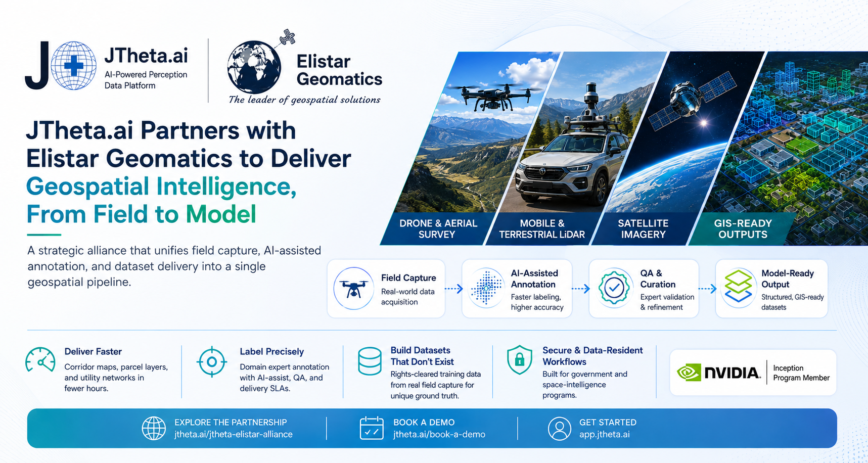
Announcing a strategic alliance that unifies field capture, AI-assisted annotation, and dataset delivery into a single geospatial pipeline.
As mapping, surveying, and geospatial AI continue to evolve, organizations everywhere are trying to turn the physical world into data they can act on — highway corridors into asset inventories, land records into queryable databases, satellite imagery into trained models. The ambition is rarely the problem. The bottleneck is the pipeline between raw sensor data and usable intelligence — which traditionally requires stitching together separate vendors for capture, annotation, and AI.
Today, we’re closing that gap. We’re proud to announce a strategic alliance between JTheta.ai and Elistar Geomatics — bringing full-stack geospatial delivery and an AI perception-data platform together as one team, from field capture all the way to model-ready output.
The Challenge: The Handoff Between Capture and Usable Data
Most geospatial AI projects don’t fail on capture, and they don’t fail on modeling. They stall in the middle — in the handoff between the field team that collects the data and the platform that turns it into structured, AI-ready intelligence.
Teams typically manage this with a patchwork of vendors and tools:
● One partner for LiDAR, drone, and satellite capture
● Another for annotation and quality assurance
● A third for dataset formatting, curation, and delivery
Every handoff adds cost, delay, and the risk of quality loss. For teams building at scale, that integration overhead is where projects lose the most time.
The Solution: One Team Across the Full Pipeline
The JTheta.ai and Elistar Geomatics alliance closes that gap by combining two complementary strengths under a single, coordinated workflow.
Elistar Geomatics brings full-stack geospatial delivery:
● Mobile & terrestrial LiDAR — centimeter-accurate corridor and asset capture
● Drone & aerial survey — orthomosaics and DGPS-controlled mapping
● Domain depth — cadastral, highway, and utility expertise across five countries
JTheta.ai brings the AI perception-data platform:
● Point clouds (3D) — LiDAR, drone, and mobile-mapping data classified and segmented into structured point clouds
● Raster imagery (2D, GeoTIFF) — satellite, aerial, and orthomosaic imagery segmented and vectorized into GIS-ready features
● AI-assisted annotation, QA workflows, and dataset curation — with defined quality standards and delivery SLAs
Together, the two teams cover the entire journey from field to model — with no vendor handoffs in between.
Proven in Production Before It's Ever Sold
The part we’re proudest of: Elistar’s own production already runs on the JTheta.ai platform. This isn’t a partnership built on a pitch deck. The alliance is used daily, at scale, in real geospatial delivery work — before it’s ever offered to a client. That means the workflows we bring to your projects are already battle-tested in production, not theoretical.
What the Alliance Delivers
By working as one team, JTheta.ai and Elistar Geomatics help organizations:
● Deliver faster — corridor maps, parcel layers, and utility networks produced in fewer hours through AI-assisted digitization
● Label precisely — LiDAR, satellite, and imagery annotated by domain experts on an AI-assisted platform, with QA and SLAs
● Build datasets that don’t exist — rights-cleared training data from real field capture, offering ground truth that public datasets can’t
● Handle sensitive programs — secure, data-resident workflows for government and space-intelligence engagements
In Their Words
“The gap between field capture and AI-ready data is where most geospatial projects lose time. Collapsing capture, QA, and dataset operations into one backbone is the entire thesis behind JTheta.ai — and this alliance is the first proof of it running at scale.”
— Vijay Shanmugam, Founder & CEO, JTheta.ai
Looking Ahead
This is the start of a shared roadmap — spanning managed annotation delivery, AI-assisted geospatial production, jointly produced training datasets, and co-developed tooling. As a proud member of the NVIDIA Inception Program, JTheta.ai continues to build the perception-data infrastructure that modern geospatial and physical-AI teams depend on.
If you’re building in mapping, surveying, or geospatial AI, we’d love to talk.
Explore the partnership: jtheta.ai/jtheta-elistar-alliance
Book a demo: jtheta.ai/book-a-demo
Get started: app.jtheta.ai